FloodAdaptVN aims to support decision-making processes of local stakeholders in such a way that flood risks in central Vietnam can be minimised by means of adapted risk reduction and adaptation measures. The project team investigates and compares ecosystem-based approaches that can be integrated into flood risk management in the study area for adaptive and sustainable urban development. Implementation aspects for disaster risk reduction are investigated by FloodAdaptVN as well as prioritisation factors for successful risk management. In order to support local authorities in developing practical measures, the project generates a sound information base on flood-prone regions. Central to this is the »capacity development« strategy, which is intended to enable Vietnamese decision makers to implement successful risk management in the long term and also guarantees an increase in knowledge and experience on the part of the German actors involved.
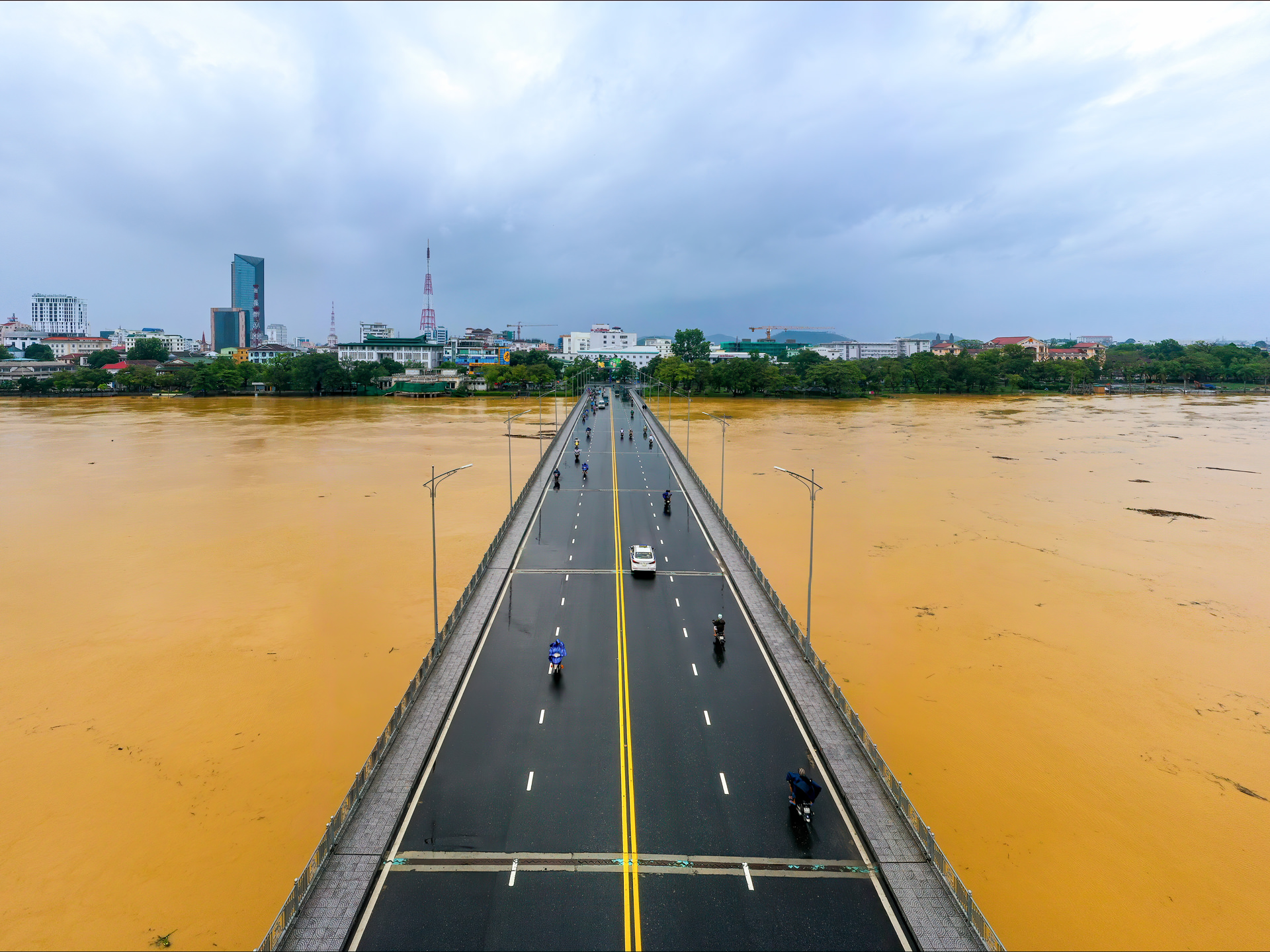
In central Vietnam, small and medium-sized coastal towns are particularly characterised by a rapid urbanisation trend. The concomitants include extensive surface sealing, the expansion of settlements into flood-prone areas, and a decline in infiltration and retention areas, so that heavy rainfalls lead to enormous surface runoff. Additionally, the narrow and flat settlement area between the inland mountains and the coast only allows very short reaction times to heavy rainfall, which is exacerbated by degraded land and deforestation. Moreover, climate change is expected to lead to stronger and more frequent extreme weather events, such as typhoons with resulting floods in central Vietnam. Such storms cause considerable infrastructural, agricultural, health and economic damage. Due to changing settlement patterns, housing and lifestyles, local vulnerabilities and civil adaptation practices need to be rethought and integrated into planning.
FloodAdaptVN rests upon a participatory, transdisciplinary research design and an extensive stakeholder network. The network is composed of local and national stakeholders as well as (inter)national experts in order to achieve the project objectives and to ensure their integration into political and planning processes. The assessment of current and future flood risks is carried out through a modular framework, which is adapted to local conditions and also transferable to other regions. Methods and products from geodata analysis, earth observation and risk and vulnerability assessment are used. Existing and planned disaster risk reduction, risk transfer and adaptation measures are identified and assessed using a multi-criteria catalogue. The modular approach will be brought together in a flood information system (»FRAME«) and made accessible to local stakeholders.
In order to reduce current and future flood risks, the FloodAdaptVN project focuses on risk management. The project addresses existing and urgent knowledge gaps regarding the identification of flood risks and adaptation approaches in urban regions of central Vietnam. At the same time, however, those measures have a high potential of also being transferred to neighbouring provinces as well as to other similar urban and coastal areas worldwide. Innovative aspects of the approach include the assessment of multi-risks on the basis of a chain of effects that reflects local and regional complexities. In addition, future risk scenarios are developed and simulated based on locally adapted »Representative Concentration Pathways« and »Shared Socioeconomic Pathways« (2030, 2050, 2100) with and without adaptation measures. Finally, a portfolio of adaptation options is identified and assessed, including risk transfer and ecosystem-based approaches. For risk-informed planning, the modular information system »FRAME« is implemented.
The FloodAdaptVN project aims at displaying present-day flood hazard. Therefore, different information from diverse sources, including Earth observation for hydrological and hydraulic modeling, scenario development, and ecosystem assessment are collected and assessed in a model chain for evaluating exposure and vulnerability. A scenario framework is in place, in which the current drivers of risk and impact chains are thoroughly assessed. Scenarios for future exposure and vulnerability of the province is finalizing.
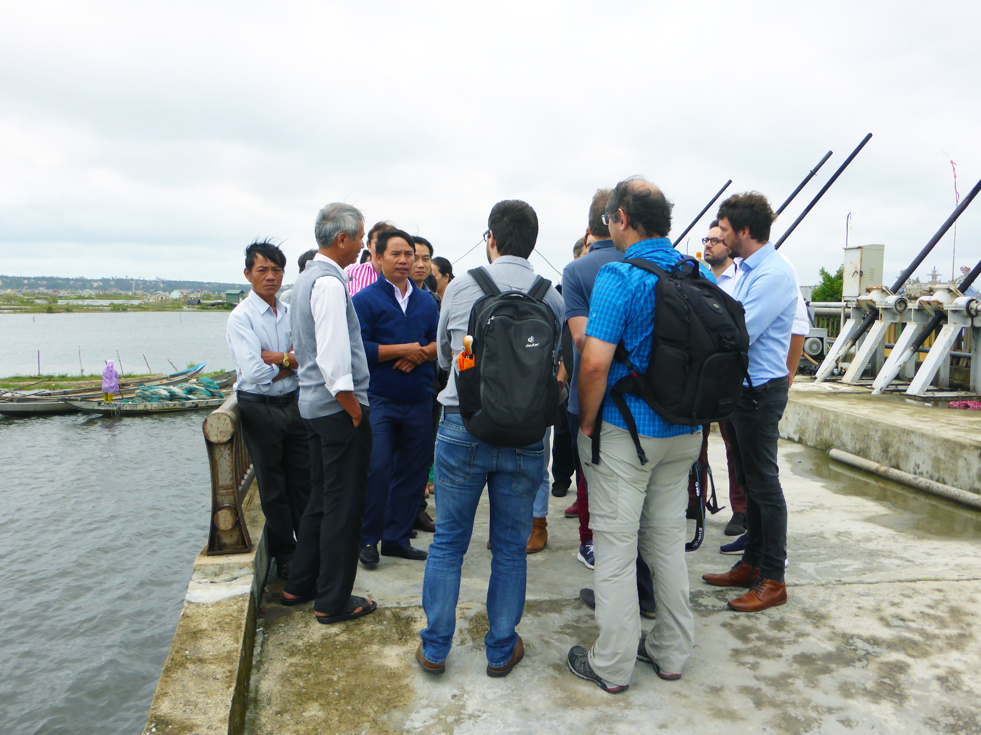
The FloodAdaptVN team were actively involved in strengthening interprovincial cooperation among stakeholders in Central Vietnam, what eventuated in the First Regional Networking Forum on Climate Change Adaptation, Flood, and Disaster Risk Reduction, held on April 25, 2023. It fostered collaboration among stakeholders from Thừa Thiên Huế and neighboring provinces (Vietnam), facilitating the exchange of experiences, identification of joint action topics, mutual learning and laid the groundwork for future cooperation with research projects and institutions.
Currently, a cost-benefit analysis of measures is underway using the European Court of Auditors (ECA) framework. The evaluation of planned risk reduction measures is in progress. Simultaneously, the risk information system FRAME (Flood Risk Assessment, Modeling, and Evaluation of potentials for additional flood risk reduction), combining the multifold aspects of the FloodAdaptVN approach, is being co-developed with stakeholders. Additionally, efforts will be directed towards preparation for the interpretation and integration of information into the planning frameworks in the Thừa Thiên Huế province.